Tuesday, June 11, 2013

Starting hydrology in Vagos

Life is not bad. For the supervisors, the day in Portugal begins with good coffee, and sometimes a pastel de nata.

Good morning Michel!
Students have to go to the Pizzeria to have internet, and when they get access they have something else to do then to write blogs. Today we had planned to install the sapflow equipment for measuring tree transpiration, whereas other groups planned to do geophysics. No such luck as these electronics do not like the steady drizzle that comes down. Of course, there are other options for a day like this, such as sampling public water holes (fontes) for water chemistry, or go and check if the discharge of your river goes up. My gut feeling says that this drizzle is no good for that, but will make you just wet and cold while you stand desperately watching the unchanging flow of river water. Me, I decided that it was time to work on this blog again.


So what have we done since last week? The day after the excursion, we decided to install the water level loggers in the streams as the weather forecast said it would rain.

Bob and Robbert installing the water level sensor in the Presa Velha stream
Then the groups went on to scout the area and install the rain gauges. When it finally did rain two days later, they sampled rainfall and did develop rating curves. For some groups this meant that they arrived at their Barra house only after ten in the evening when it got too dark to continue.

Other students tried to maximize their efficiency by driving as close as possible to their Presa Velha River discharge outlet in their rental car, that is not supposed to go off road. This is all very nice when the Cretaceous clay (C5 formation for insiders) is dry, but not when it starts raining and the clay decides to turn into a slippery surface, steering the driver (not Rosa!) into a ditch.

Digging was no good, so friendly farmers had to pull out a student's car while Rosa shouted out her joy in her best Portuguese
Unable to speak any Portuguese except "bom dia" and "sim", the group used their smartphones to show a proud owner of a tractor what they had done, so that this kind man could save them from staying overnight in the field.

Joris programming a 1990s VU made water level logger, the best you can get!
Piezometers have been invented by mankind to measure ground water level or quality. You can also do this in big wells, but then there may be all kind of disturbances, like vegetation, garbage or fish.

Looking into an old well to fish and a frog.
The advantage of wells, however, is that they are very hard to destroy and easy to find back. Not so our piezometer near Corticeira da Cima - of which only a damaged cap and some yellow tape was found back - or the notoriously bad-smelling VU4 piezometer near Tabuaco, which became buried under sand during logging and replanting of eucalypt forest. This one was only found by sheer luck when Louise randomly poked a stick into the soil to find the small blue tube. It took us hours to clean it from all the sand that had entered the smelly tube.

Thomas having a go at cleaning VU4 piezometer
Rather than rely on old, second-hand piezometers, the Mesas group decided to install their first brand-new one between four pinus trees.

Mesas group with their first piezometer still to be decapitated.
While installing a piezometer requires strength, perseverance and and sometimes brute force, the approach for a installing a meteorological tower requires delicacy and care not to damage the sensitive equipment. These are skills that Maartje, Patricia and Louise showed while attaching the instruments to their support arms and connecting them to the datalogger, whereas Corne (hates dish washing, likes smoking) and Seife did the more earthly jobs of augering away.

Patricia, Maartje and Louise working on the meteorology tower

Seife and Corne installing the tipping bucket rainfall recorder - kids play - just practice for the real thing...


After practicing on the rain gauge, Seife manages to put the casing into the soil without using his hands, while Patricia and Louise look on in admiration...
Then the water balance team finally came together to point the wind vane exactly to the North, using Louise up in the tower for adjusting the vane dirtection, a compass and a line of team members indicating the north to Louise.

Wind vane should point to the North.
We now use the Apple Ipad and the Campbell Scientific Loggerlink app to view and download the meteo data through a wireless connection, that's called progress (Thanks Ron)!

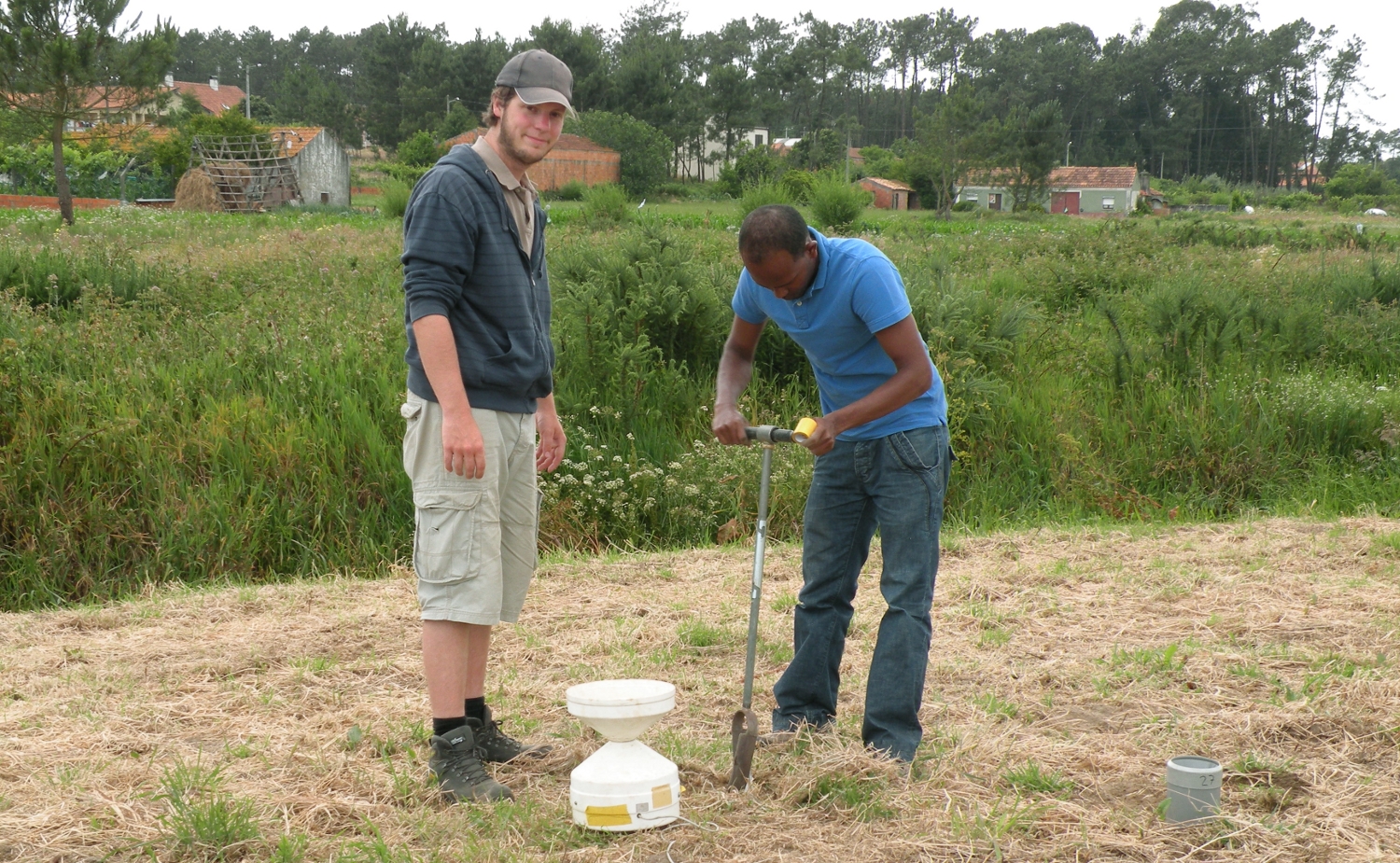
Finally, let's not forget our BSc students who were still busy on their tiny island, working away with the VU spiral auger to find and sample fresh water. For the connoisseurs, they found a shallow layer with an electrical conductivity of 825 microSiemens/cm, which is drinking water quality!

Marijn and Valerie in pursuit of fresh water
Again, this is the place to thank all the technical staff in the electronic and mechanical workshops and the water laboratory at the VU University, who develop, make, maintain and prepare for use all this specialised equipment for us. Frans, Ron, Hans, Niek, John, Tinko and all others, without you, we would be lost!

Tuesday, June 4, 2013

The first days in North Portugal

The sky is crystal blue and my skin burns from the sun. In other words, a perfect day for field work. The students all have arrived, two BSc students from Holland, and 19 MSc students from the Algarve, where they got to know the hospitality of our Portuguese hosts and learned about hydrological system thinking from Henk, Richard and Yvonne.

Today, Joana, an MSc student from the Geosciências Dept. of the Aveiro University, also had her first meeting with the experienced VU student field crew and she looked happy. They all stay together with Sr. Afonse who has six apartments, and now a lot of instruments in his hallway...

Student field course house in Barra, just next to the beach...
Nearly the first thing we did was going to a tiny island in the Ria de Aveiro Estuary with the BSc students. The question is how small an island can be to have a freshwater lens floating on top of the seawater. Their goal is to measure the permeability of the island, its vegetation, topography and most important, find its "freshwater heart" using a VU University developed spiral auger sampler. The island is as tiny as we could find and only accessible during low water as we do not have an outboard this year for our boat. Here you see them in action...

VU University Earth Sciences BSc students Marijn and Valerie on a tiny island using Dutch and a spiral augers, respectively. Michel watches Marijn's performance.
If you don't want to get trapped on the island, you'll have to watch the tide, and the fishermen leaving the mudflats.

Returning home from the island (background), through the Ria de Aveiro mud, after having lost a shoe. Bringing geological knowledge about mudflats in estuaries in practice.
The next day, we went to introduce our MSc students into the delicacies of the geology of their study area. This includes measuring the resistivity of the Cretaceous C5 formation, which can transform in a lot of muddy clay too, as Bob and some others discovered while taking a short-curt walking along the in shore of the lake.

Geophysics by the lake
Just before lunch at Mario's Cafe-Bar Veneluso in Montouro we arrived at a sandy Cretaceous formation from which you could pump loads of water, that is if it would have been saturated. Here we looked at cross-bedding and a nice micaceous layer that gives you silver hands, and classified the layer as a fluvial deposit of arkosic sand because there were still feldspar grains visible next tot the quartz and weathered biotite grains. 

MSc students Hydrology VU Amsterdam 2013, in front of a Cretaceous sand formation, hmm, very interesting
Michel took the group picture above, as he had not shaven on this morning. Furthermore, people make mistakes. Making a mistake was what the baker did when he used the new yellow soap, instead of the regular butter, to prepare a croissant in the middle of the night. The second mistake was that Michel bought it and ate half of it, before deciding that the bitter taste of this morning's bread was not normal. The baker never physically felt the consequences of his error, but Michel experienced mild cramps while sitting next to me in the car, and probably will now hesitate ordering croissants with his morning coffee. Such hardships. More on our hydrology adventures tomorrow (installation day).

Tuesday, May 21, 2013

Faro


We started our first excursion day with investigating several wells and relating the the landscape and hydrologic properties of the region to the geology. 


At the quarry we could see karstified limestone. There we estimated hydrologic properties and chemistry of the groundwater.

At the end of the day everyone is happy to go back to the hotel again.

Saturday, May 11, 2013

Groundwater pumping

Laurus wanted to train his biceps today, he had cycled with the cart behind his bicycle for many days training his legs and felt that he needed to train some other parts of his body, all to impress of course. So to accomodate him we went to install a piezometer and do a pumping test.

Laurus in mental preparation while Eisse takes notes and translates Dutch expressions to English
Installing a piezometer by hand is quite a happening and looks funny if you are the person working the casing into the ground. But hey, anybody can do this.

Anne looking happy while Thomas trained his muscles and Koos standing by

 After this exercise the pump was ready and everybody took their positions around the observation wells. Koos explained how to use the water level sounding devices. 

Worshiping a sounding device

Pumping started and the sounding devices strated screaming like pigs. Here is an action picture of the pump,Joris and Aikaterini and Eisse without head.

The pumping test by students

Hooghoudt auger hole method

Being in Holland we use bikes for transport, even if we need to bring some heavy equipment. Our excellent mechanical university workshop produced some cart that are great in use, even on the sandy roads that we use in this course.

Bicycles packed and ready to leave on a cold day at Camping Meuleman in  Twente

A method that makes students nervous is always nice to teach. In this case it requires teamwork and fast reaction as the whole experiment is over in about 10 seconds. We measure the hydraulic conductivity (or permeability of the soil for water) with three methods. The first one is by the ring infiltrometer. This is a nice a method which does not require eagle eyes or fast reaction as the "bubbles" that need to be recorded are quite slow leaving students time to mull over the meaning of life and other irrelevant questions.

Thomas and Anne reading a Mariotte bottle during a ring infiltrormeter test

Asta and Patricia in action on the Dinkle river beach under close supervision of Robbert
This is not so for the method with the unpronounceable Dutch name, no time to think at all, just rapid action. This is a test where some water is pumped out of a filter installed in the saturated zone. As this beach is sandy, water will flow in fast and the rise of the water level that needs to be measured with a divice as simple as it is ingenious. Here you see Robbert bailing out water from the well, while Asta holds the measuring tape, Anne is ready to write, Thomas has the stopwatch and Patricia was just too cold to do anything but shiver.

Start of the action, all is relatively calm at this stage
Asta reading the measuring tape every two seconds while Anne writes things down.
After a failure in communication during the first try (happens always) the other attempts were all succesful and the data is in. Later more about the pumping test...


Wednesday, May 8, 2013

Start of instrumentation field course Twente


The first day of the field course was an excursion to see the geology of the Dinkel River valley in Twente, This landscape was shaped by the ice cover that existed during the last ice ages. We started the rotation of groups yesterday. Koos teaches river discharge measurement techniques, Michel does the geophysics, John makes a bicycle tour to study variation of hydrochemistry along the Dinkel River and its tributaries and I am doing soil physics and micrometeorology. The four groups of students follow all these day programmes by a rotation system. 
 
We are studying, while a lot of Dutch celebrate a short holiday or are getting their wedding pictures taken. You can see the activity in the picture below, where we do TDR soil moisture measurements on a popular beach along the Dinkel River. 

Soil moisture measurements on the Dinkel beach
 
At the same spot, Bart, Jelmer, Jet and Vince were having a tensiometer party today and when we went to the meteorology tower afterward, we saw another group of students doing geophysics in a meadow of a very friendly dairy farmer.

Bart, Jelmer, Jet and Vince with tensiometers

EM-34 geophysics in grass


Tuesday, May 7, 2013

Arrival in Twente

Sunday Afternoon, beautiful weather to start a field course! We just arrived and settled in the camping houses. In the evening Koos gave a short lecture of what we are up to. Picture below was taken in the tent that was set-up for us to use for lectures and data processing.

First session in the tent...
Today we did soil physics. More to follow later.
Students pushing the trailer in the parking spot.